Menu

GBD-WebSuite
- Support for the provision of QGIS projects
- Fast display through data cache
- Integration of external services, also directly in the client
- Provision of WMS, WMTS, WFS, WCS and CSW
- Query of map objects with a click and mouse-over
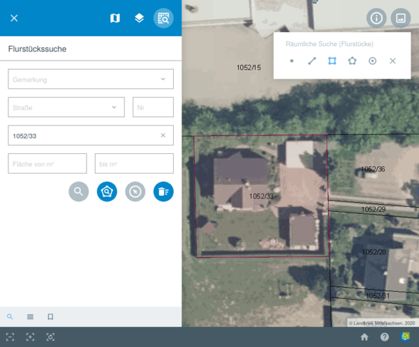
- Spatial search for objects on the map
- Dimensioning of segment lengths in the map
- Display of the current position on the map
- Parcel search, information and printing
- Dynamic provision of INSPIRE-compliant services
- Digitizing point, line and area objects
- User authentication and rights management