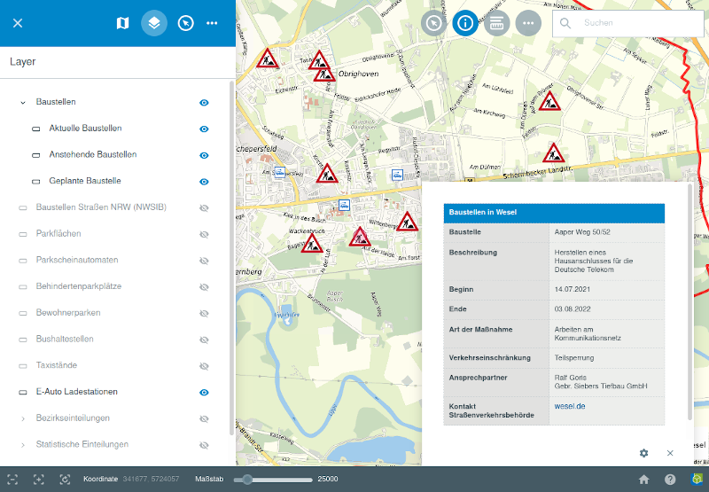
In the construction sites module, it is possible to symbolize traffic signs of the StVO (work place, diversion, lane use, ...) at the point of construction as well as line and area elements such as diversions or affected areas around a construction site. When you click on it, a window opens and displays the relevant information. It is also possible to attach documents.
The display of the map is controlled by a QGIS project. This enables complex symbolization and labeling in the WebGIS. For the management of construction sites, a module was developed that accesses the generic functionality of the GBD WebSuite (e.g. editing geometry and attribute data or creating forms) and dynamically provides an administration interface that can be individually configured to organize construction sites.