Since 2004, together with our partner nature-consult, we have developed and established a method in which classic, area-wide vegetation mapping is combined with modern methods of multispectral image data analysis. have developed and successfully applied in numerous projects. It is about the combination of remote sensing, GIS evaluation and verification in the field for efficient and high-quality vegetation recording in large-scale project areas.
Example projects were:
- Mapping of the entire terrestrial areas of the Lower Saxony Wadden Sea National Park with around 33,000 hectares from 2004 - 2006.
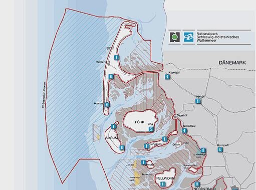
- Vegetation mapping of the salt marshes on the west coast of Schleswig-Holstein with around 15,000 hectares from 2006 - 2008.
- Recording of the reed beds and adjacent vegetation units near the banks of the Lower and Outer Elbe with around 10,000 hectares from 2007 to 2008.
- Vegetation mapping of the dike forelands on the Lower and Outer Weser and in the Lesum / Hamme / Wümme area with around 8,000 hectares based on a digital aerial survey in 2008 using semi-automatic classification in 2009 and 2015.