An important part of the development and implementation of the new spatial data infrastructure consists of the integration and provision of data from a wide variety of specialist areas, the official real estate cadastre (ALKIS) and aerial image data. All geodata were transformed by Gauß-Krüger into the ETRS89 coordinate system.
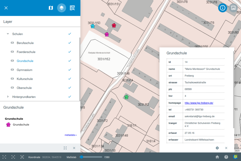
A new geoportal was created with maps from various subject areas such as: waste, basic data, the environment, construction and forestry.